Engaging line
Code Survey team make’s complete effort to be your base line for GIS, Photogrammetry, LiDAR, CAD & Web experts - Code Survey.
What we offer
GIS
PHOTOGRAMMETRY
LIDAR
CAD
WEB

Step one
Project discussions and confirmation by mutually agreeing on highlevel requirements and tentative delivery timeline with highest quality.


Step two
Work with the client and review the detailed project requirements. Multiple rounds of communication may be needed during this phase w.th respective to the project inputs or for any additional inputs/requirements/clarifications.
Step three
Arranging and Processing the project as per the requirments.


Step four
Deliver the best quality project data tot he client after performing the QA and QC process.
GIS Technology
Services Offered
Image Processing

Parcel Mapping

Parcel maps are typically maintained at a variety of scales,which shows only diagram layouts,legal description documents describing boundary ownership for a given parcel. Parcel maps of an area provide more than a representation of ownership.
Legal boundaries for public and private properties. Code Survey conversion products provides location, size, shape, and parcel identification number. This allows for easy identification of where a specific property is located relative to adjacent properties and public roadways. Parcel data is derived from existing maps (scans or hard copies) and legal information by geospatially registering imagery using a heads-up digitizing technique. Parcels also can be collected by employing COGO methods to enter the legal meets and bounds. These parcel mapping processes are used to create a new parcel base map or update an existing base map for AutoCAD or ESRI environments.
Geo Referencing

Land Use Mapping
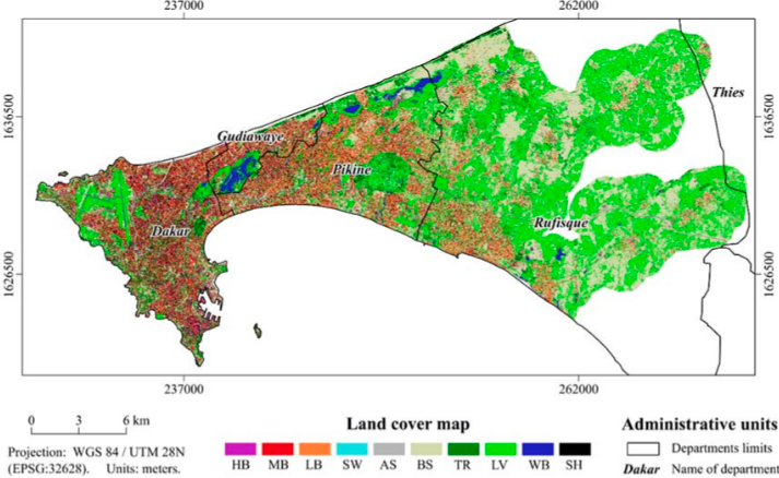
- Water and drainage
- Urban development planning
- Vegetation Coverage
- Irrigation purpose
- Recreation spaces
- Planning of green spaces for various use in the development
LiDAR (Light Detection & Ranging)
Services Offered
LiDAR
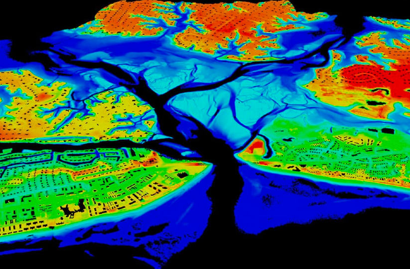
Following services are offered:
Bare Earth Classification
All Features Classification
Powerline Classification
PLS CADD Conversion
PLS CADD Mapping
Terrestrial
Photogrammetry
Services Offered
Photogrammetry
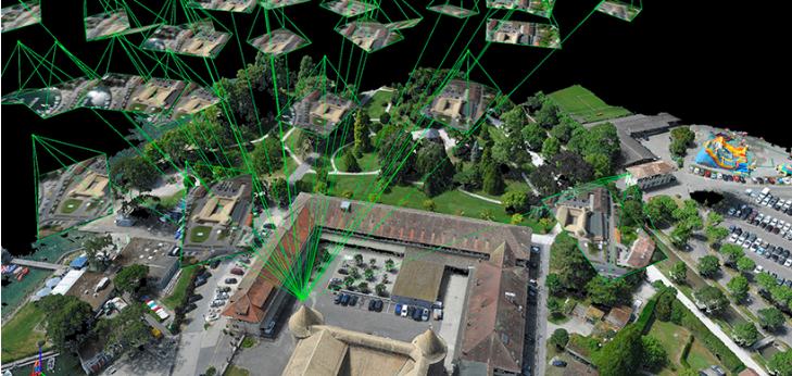
Following services are offered:
Aerial Triangulation
DTM
DEM
Mapping All Scales
UAV
Othro
CAD Engineering
Services Offered
CAD
WEB Services
Services Offered
WEB
UAV
Othro
About US
Code Survey LLC
Code Survey always employs the best draftsmen, GIS and CAD engineers, Mapping Experts, LiDAR technicians, 3D experts, Web Developers. Our cost effective quality services it's going to be a win-win situation.
Utilizing latest applications and tools, we provide quality Mapping, Data Management, Image Processing, CAD Engineering, BIM, LiDAR & 3D Mapping services.
We are the premier service provider in the areas of GIS, CAD, LiDAR, Photogrammetry & Web services and provide wide range of geospatial services across GIS, floor plans, remote sensing, Photogrammetry, LiDAR and CAD engineering, CAD drafting.
Contact Code Survey LLC
MIG : 90
KPHB Colony
Hyderabad
Pin Code : 500072
India
Contact : +91-9618069572
Email : kumar@codesurveyllc.com